Interactive street maps in JavaScript
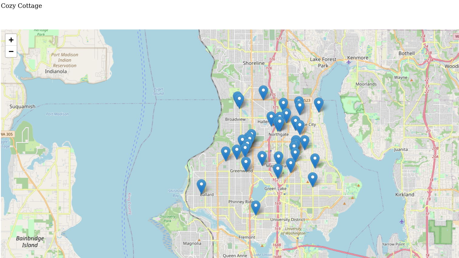
During summer of 2019, my then-girlfriend (now wife) and I started looking at buying a house. Due to Seattle’s infamously hot housing market, we ended up looking at >30 houses before making an offer. The geek in me saw this as an opportunity to do some mapping and visualization, and also learn some new technologies.
The last time I worked with maps, it was on a larger scale and I didn’t have to worry about street addresses. This time, I imagined an interactive map that would show the location of each house we looked at, along with metadata so we could potentially look at trends. I was also interested in using open-source mapping service, rather than GoogleMaps.
1. Choosing a JavaScript mapping framework
Since my map would be web-based and interactive, I thought React would be a good fit since it’s a widely used JavaScript framework with a few different mapping solutions: google-map-react and react-map-gl. After some digging, however, using React just to make a clickable map seemed a little overkill to me. I settled on Leaflet which was lighter weight and also supported some interactivity.
2. Choosing an (open-source) mapping service
Next, I looked into several services providing open-source mapping data: OpenStreetMap and MapBox, which has a free tier, ultimately settling on the former since I didn’t need MapBox’s more advanced features.
3. Performing geocoding
Mapping the street addresses I have to geographical coordinates (“geocoding”) can get a little complicated. Thankfully, since it’s a fairly common problem, there are tons of tools available. I naturally gravitated towards R, where there are some excellent packages like tmap and tmaptools. These combined with OpenStreetMap’s API gave me latitudes and longitudes of the houses in a few minutes. As I do with many new datasets, I also did a bit of exploratory data analysis.
4. Reading geocoded data into framework
In looking for ways to load my coordinates into the webpage, I again became cursed with options: there are simply too. many. solutions. Could a guy just not have an open() call ? In any case, I settled on using D3, which had a simple 2-line solution.
5. Host the results and test

Lastly, though JavaScript itself started out being client-side, the mapping API calls means that I still need to have a HTTP server that could host the final prototype. Since this was just a fun personal project, I opted to forego an ISP and just run my own personal HTTP server on the source directory using python3’s http.server module.
You can see the source for this project, which I call CozyCottage here. I took a screenshot above in case the mapping API changed (which it did a while after I originally made this post).